 Download PDF
How do you get to know a city without being able to visit it? That’s the question we had to answer during the periods of physical distancing and travel restrictions between 2020 and 2021, when everything seemed to stand still while planning continued. At TPS, we thought: why not turn necessity into a virtue? From the social analysis activity through newspapers and social media that we experimented with and perfected during the pandemic period, the analytical method of press mapping or press review analysis was born and developed. The goal at that time was to replace site visits with a “from home” analysis; we discovered that press mapping is a powerful tool for gaining a unique and specific perspective on a location. Let’s analyze the specific case of the SUMP of Vicenza, but the considerations expressed apply to all other plans in which we have used this methodology.
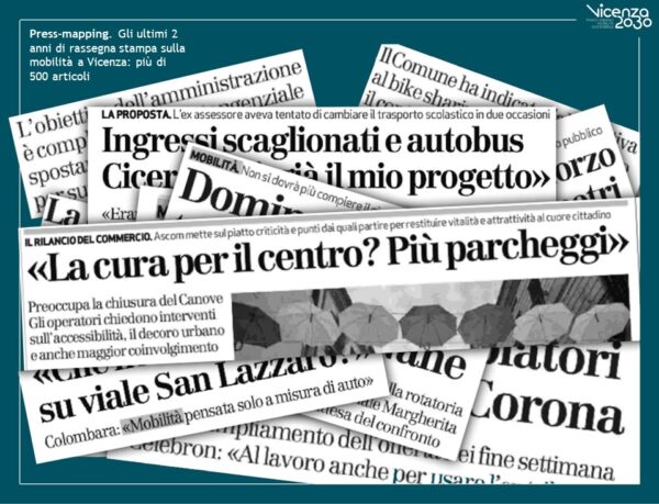
In the case of the Sustainable Urban Mobility Plan (SUMP) of Vicenza, as a complement to the knowledge framework and as a preliminary step to participation activities, an analysis of the local press review provided by the Municipality was conducted over a period of 24 months from January 2019 to January 2021. The search keys were set as “mobility,” “degradation,” “cycle
path,” “sharing,” “mobility,” and “road system.” The consulted newspapers included “Il Giornale di Vicenza,” “Corriere del Veneto ed. Vicenza (Corriere della Sera),” “Il Gazzettino – Ed. Vicenza/Bassano,” “vicenzatoday.it,” and “ilgiornaledivicenza.it.”
The methodology of press mapping is as follows:
- Choose themes for research.
- Select newspapers for research based on the relevance of the theme and the availability of materials.
- Set up an organized database to collect information and catalog articles.
- Define a significant timeframe for research.
- Establish a minimum target of articles to catalog.
Thanks to press mapping and the articles read and cataloged, analyses were conducted on emerging issues, the most discussed themes, and those to which the population was most attentive during that period. This contributed to the Plan by providing useful indications to designers to build the participatory process, offering an initial framework of topics, and framing the sentiment, temperature, and mood regarding mobility issues for those living in and visiting Vicenza during that period. Furthermore, another aspect not to be underestimated is the reversal of cognitive bias. The press analysis, although qualitative, is conducted with a rigorous and non-interpretive method: therefore, it provides a partial picture of the location, but not distorted by evaluations based on the prejudice of those conducting the analysis.
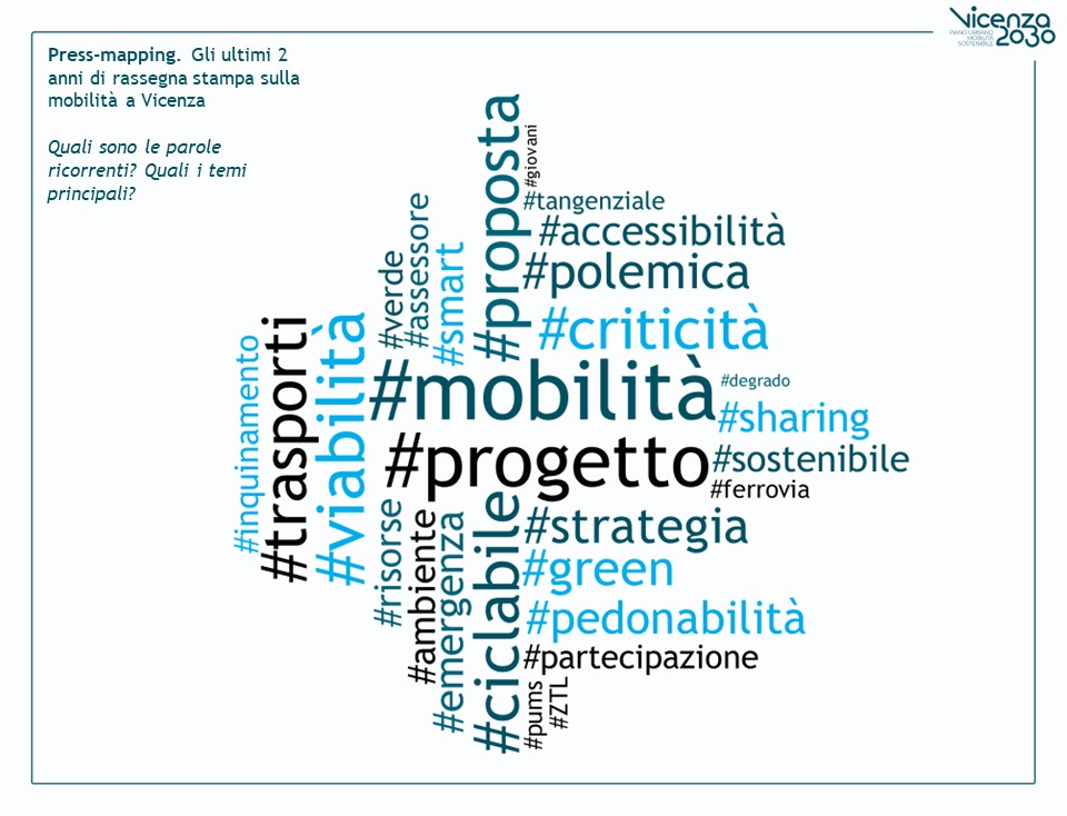
In the press mapping of Vicenza, many themes related to mobility and sustainable mobility emerged, in particular: local news focused on a variety of ongoing and planned projects aimed at changing the city’s layout even before the implementation of the SUMP. The mobility theme was, therefore, widely debated, and the population was attentive to the topic.
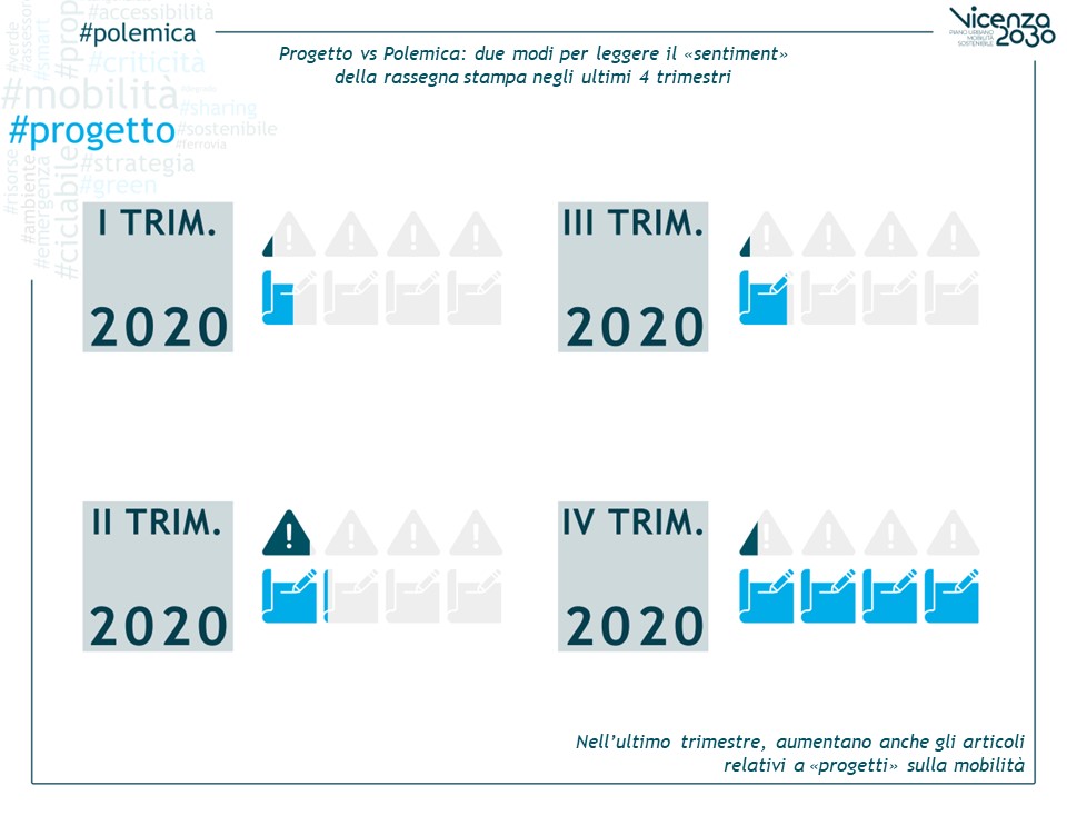
One way of categorizing articles was dividing them into those that addressed the issues by describing the project and those that focused on the polemical side to stimulate discussion. One analysis involved dividing the articles into quarters and analyzing the trend of topics throughout the year: articles with a polemical tone had a slight peak in the second quarter, while more neutral articles describing projects saw a surge in the fourth quarter.
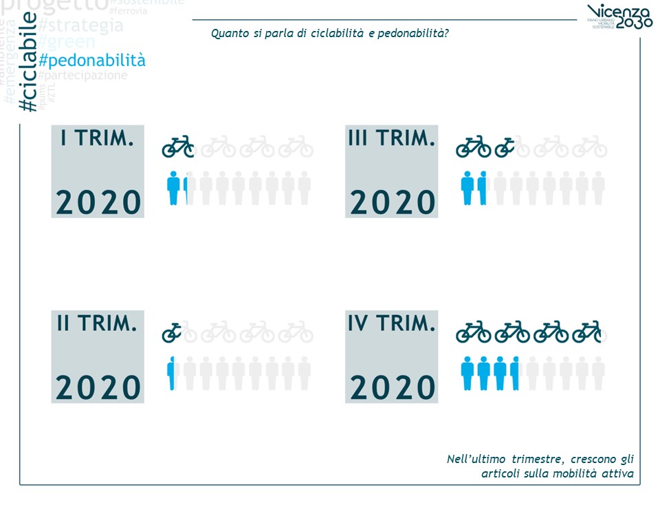
Another classification that was considered significant was the recurrence of articles addressing the themes of cycling and pedestrian mobility. The trend was analyzed, observing a growth in attention to the topic.
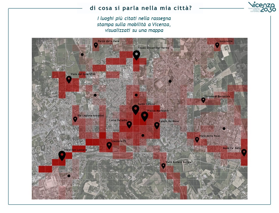
One of the most interesting analyses involved geolocating the articles, creating a concentration map of the areas most “covered” by the press. In general, press mapping has proven to be a useful tool both for getting to know a place without being able to visit it and for familiarizing oneself with it before visiting. This method of analysis provides a unique perspective on the location, determined by others’ perceptions: this allows planners to analyze the gap between perception and reality (as emerged from quantitative analysis) before their judgment is tainted by personal perception.