 Download PDF
The goal of the Municipality of Olbia was to develop a plan for cycling and pedestrian mobility that met European mobility standards. The shared choice was to create a single document for both the BiciPlan and the PediPlan, to strengthen the concept of integration between the two active mobility systems. The result is a single document where common parts and exclusive parts of the two plans can be recognized. The chosen slogan is BiciPlan e PediPlan: un cambio di passo sostenibile per Olbia (BiciPlan and PediPlan: a sustainable shift step for Olbia) as it encapsulates the essence of the two plans and the desire for a gradual but inevitable change in Olbia’s mobility. Furthermore, the wordplay “shift step” expresses both a concept of change and a further reference to the two main forms of active mobility: cycling (change) and pedestrianism (step).
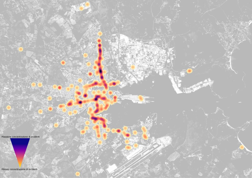
For the development of the BiciPlan and PediPlan, an analysis of road accidents in the municipality of Olbia was carried out by examining data on accidents involving personal injury collected by ISTAT. Spatial geolocation is crucial for identifying the streets where pedestrian and cyclist accidents most frequently occur. It is essential to determine how to enhance the safety of vulnerable road users in these areas. This analysis is fundamental for identifying the axes where reserved and
protected spaces for cyclists should be planned to separate them from motor vehicles.
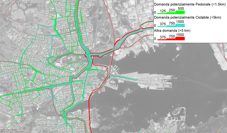
Floating Car Data (FCD) is one of the most recent innovations in data collection. Some insurance companies offer users the option to install one of the so-called “black boxes” inside the vehicle to monitor their behavior and provide discounts. These data can be anonymized and sold and are crucial for transportation planning. The challenge lies in obtaining a truly representative sample of the universe. In the case of a BiciPlan like this, where traffic flow models are not required or developed, FCDs are very useful for describing the car movements of the residents of Olbia, especially in terms of origin and destination, frequency, and distance traveled.
The outcomes of these and other analyses have led to the construction of the Plan, structured around four important themes: cycle tourism, safety, accessibility, and compact city. The four themes are articulated into as many strategic axes:
- – Axis 0 – Hospitable and Welcoming Olbia
- – Axis 1 – Safe and Connected Olbia
- – Axis 2 – Every Day Accessible Olbia
- – Axis 3 – 15 minutes Olbia
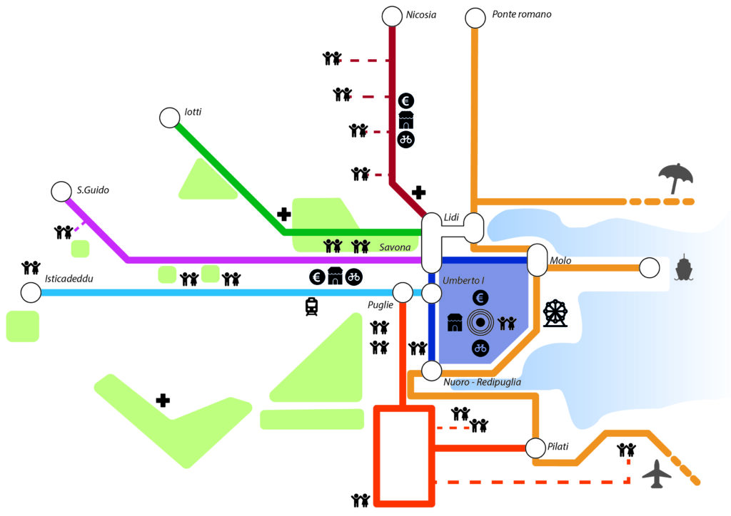
The actions falling within the scope of Axis 0 aim to enhance cycling along the coast, with particular attention to cyclists wishing to explore the northern part of Sardinia. The name itself, Axis 0, sets it apart from the other three because of its unique characteristics. The main difference from the other axes is its extension, which extends beyond the urban area of Olbia and serves the beaches and tourist attractions. The longitudinal infrastructure must ensure safety for cyclists and follow the overarching regional itinerary. Furthermore, specific services for cycle tourism need to be provided along the route.
Axis 1 encompasses all actions and interventions aimed at increasing the safety, both real and perceived, of vulnerable road users. The itineraries of Axis 1 constitute the backbone of Olbia’s cycling system and cover most of the access routes to the city center, where the majority of road accidents occur.
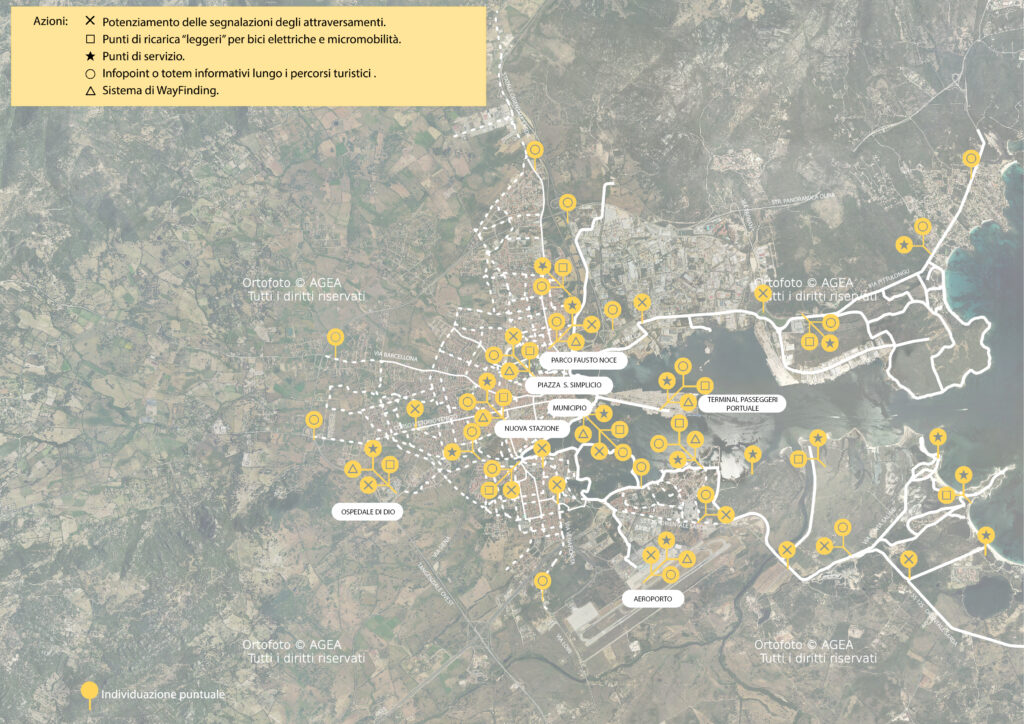
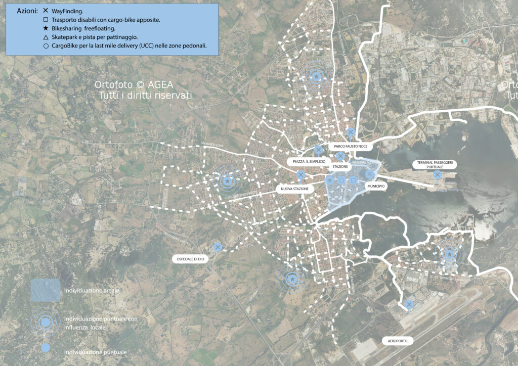
Axis 2 aims to establish a secondary and distribution network that, by integrating with the main axes structured according to the indications of Axis 1, connects all points of interest and areas of the city. These secondary routes will be implemented through cycle lanes or shared areas to minimize infrastructural interventions and according to the approach of sharing road space under 30 km/h conditions. The secondary axes are distributed throughout the urban center of Olbia with the aim of ensuring the widest possible coverage of the cycling network. Within this axis, some actions are identified for two central themes considered crucial for the future of Olbia: accessibility for disabled users and accessibility to educational institutions.
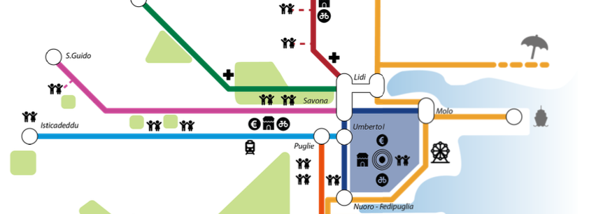
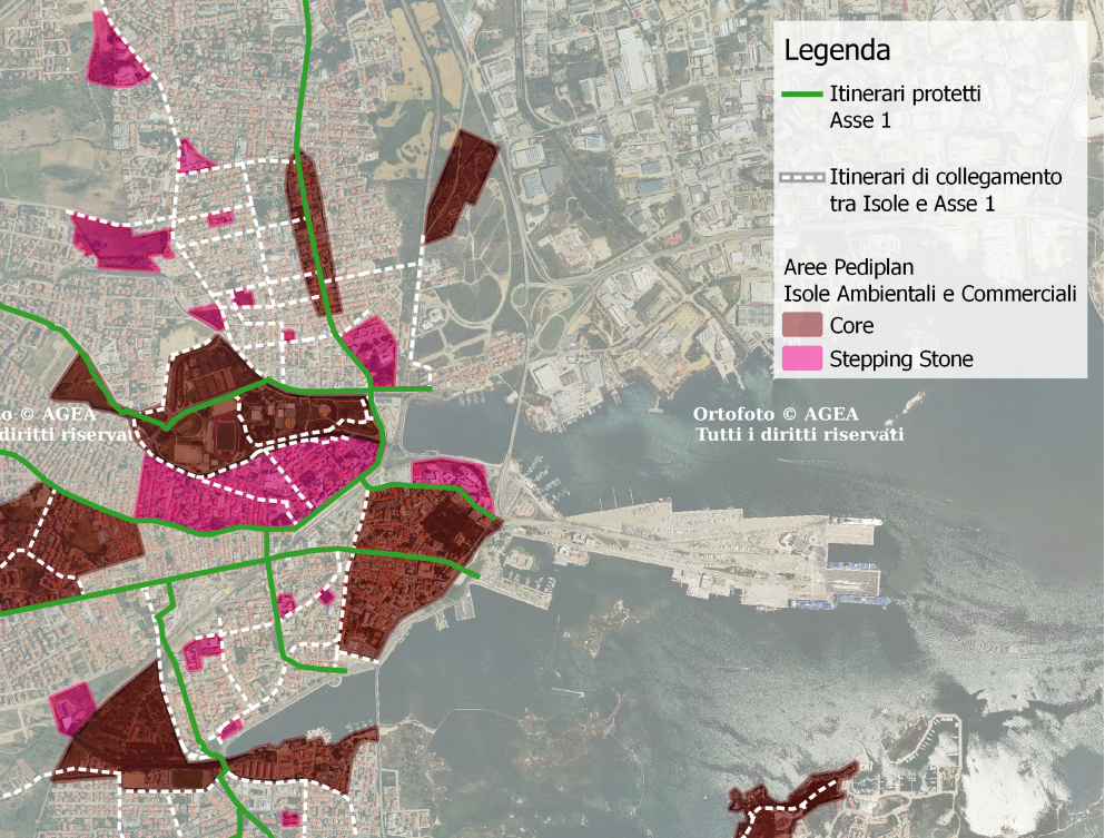
The last axis represents the core of the PediPlan. The main purpose is to reactivate a pedestrian network within the city of Olbia. Preliminary investigations and studies have shown that walking is the least used mode of transportation for daily travel. The focus has been placed on schools, reversing the current situation, and implementing interventions and policies to make them more accessible by foot, bus, and bicycle. It was decided not to proceed with a widespread planning approach but rather with pedestrian areas/islands connected by the Active Mobility Axis Network and secondary routes, creating an archipelago of Environmental and Commercial Islands.
The work was carried out in collaboration with the D:RH and Criteria studios.